Atradius Atrium
Get direct access to your policy information, credit limit application tools and insights.

 Australia
 Austria
 Belgium
 Brazil
 Bulgaria
 Canada
 China
China
 Czech Republic
 Denmark
 Finland
 France
 Germany
 Greece
 Hong Kong SAR
 Hungary
 India
India
 Ireland
 Italy
Italy
 Japan
Japan
 Lithuania
 Mexico
 Netherlands
 New Zealand
 Norway
 Poland
 Portugal
 Romania
 Singapore
 Slovakia
 Slovenia
 Spain
Spain
 Sweden
 Switzerland
 Turkey
 United Arab Emirates
 United Kingdom
 United States

Maritime trade remains the backbone of international commerce. Geography and transport costs have always shaped global exchange, and the sea continues to offer the unrivalled efficiencies that underpin modern supply chains. More than 80% of global merchandise moves by sea, illustrating the extent to which the world economy still depends on the maritime corridors that have channelled commerce for centuries.
History makes this continuity unmistakable. Across civilisations, prosperity has consistently followed control of maritime routes. From the earliest trade networks in the Mediterranean and the Indian Ocean to the long‑distance oceanic corridors opened by Venetian, Portuguese, Spanish, Dutch, and British expansion, global commerce has advanced through the mastery of strategic sea passages.
That pattern endures. Today’s economy relies on a small number of concentrated, highly exposed maritime chokepoints whose vulnerability represents a defining structural risk for international logistics and global trade stability.
Although oceans cover about 70% of the planet’s surface, global trade does not move freely across this vast expanse. Instead, a disproportionate share of maritime traffic is funnelled through a handful of straits and man‑made canals that occupy only a minute fraction of total ocean area. Their strategic relevance comes from this extreme concentration: when one of them is disrupted, global trade routes have limited room to adapt.
Chokepoints are the narrow arteries of global trade, exposing both the connectivity and fragility of the system. In a world of rising volatility, anticipating and mitigating chokepoint‑related risks has become essential.
According to Christian Bürger, senior editor at Atradius: “Chokepoints are the narrow arteries of global trade, exposing both the connectivity and fragility of the system. As system‑critical nodes, they enable smooth global flows when functioning well, but any disruption triggers immediate and widespread repercussions across supply chains, freight markets, and production networks. In a world of rising volatility, anticipating and mitigating chokepoint‑related risks has become essential for companies operating internationally”.
Only a handful of maritime passages qualify as critical chokepoints due to their traffic volume, lack of substitutes and strategic importance for global flows of goods, energy and raw materials. The most significant are the Strait of Malacca, Strait of Hormuz, the Suez Canal, Bab el‑Mandeb, the Panama Canal, and the Taiwan Strait. Other strategic passages, including the Turkish Straits, the Strait of Gibraltar, and the Danish Straits also shape regional and global trade dynamics. Let’s explore each in detail.
.2026-04-29-06-49-12.png)
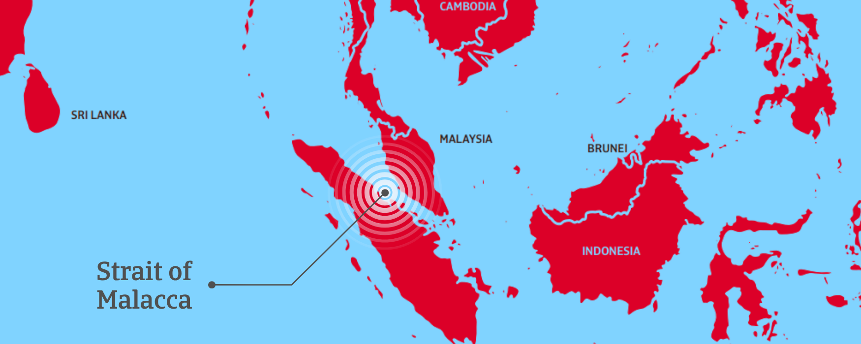
The Strait of Malacca is the busiest shipping lane in the world and the shortest maritime route between the Indian Ocean and the Pacific Ocean. It is essential for connecting major Asian economies such as India, China, Japan, Taiwan, and South Korea to the global value chain, carrying roughly a quarter of the world’s traded goods.
Length: 930 km | Narrowest point: 2.8 km
Bordering territories: Malaysia, Indonesia, and Singapore
.2026-04-29-06-52-20.png)
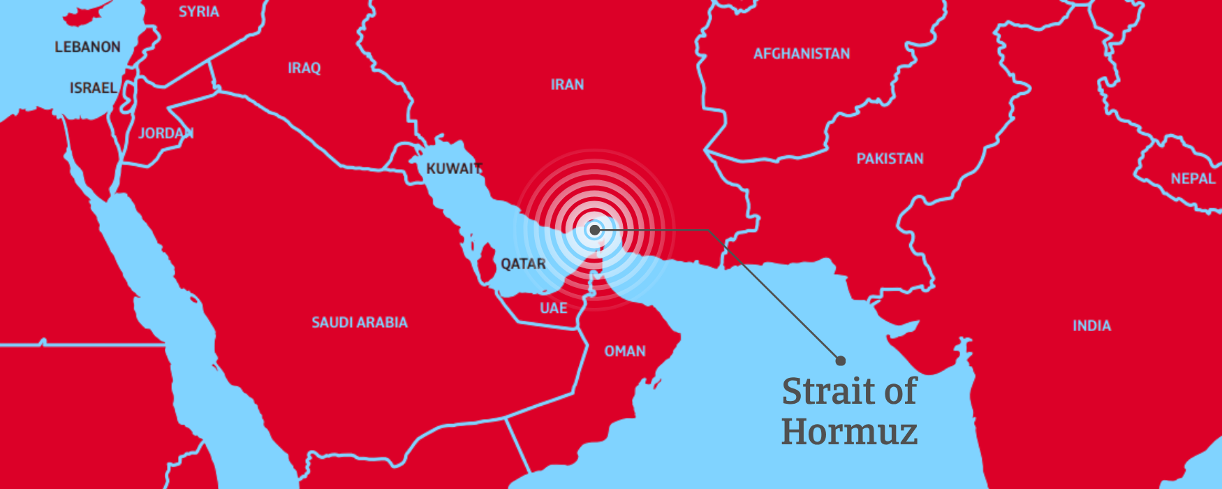
The Strait of Hormuz is one of the world’s most strategic maritime corridors and the most critical energy chokepoint globally. It connects the Persian Gulf to the Arabian Sea and serves as the only maritime outlet for major oil‑producing economies, including Saudi Arabia, Iraq, Kuwait, the UAE, and Iran, enabling their exports to reach markets across Asia, Europe, and beyond.
Length: 167 km | Narrowest point: 33 km
Bordering territories: Iran and Oman
.2026-04-29-06-55-53.png)
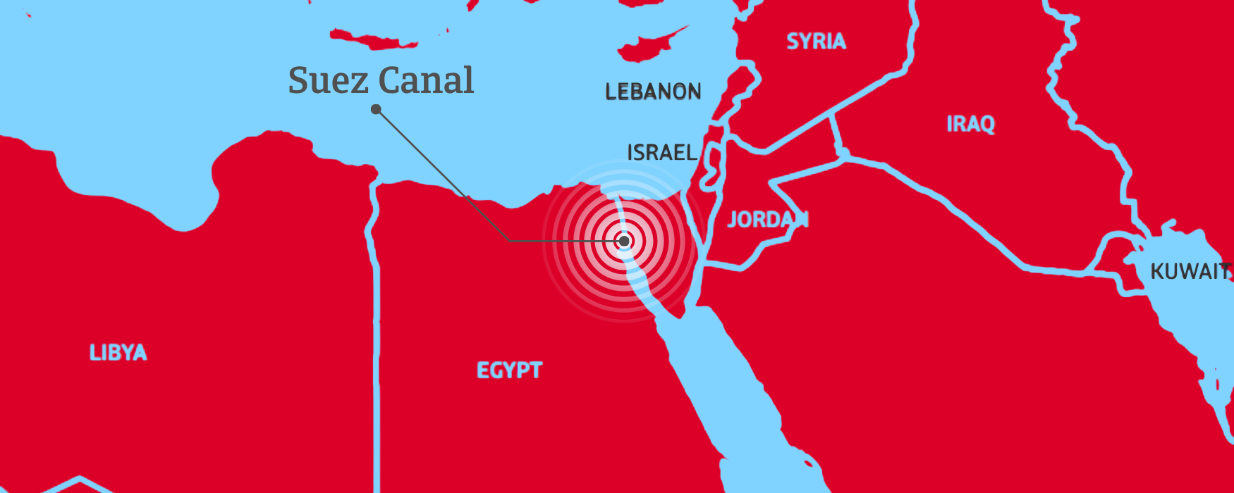
The Suez Canal is a man‑made, sea‑level waterway linking the Mediterranean Sea with the Red Sea, providing the shortest maritime route between Europe and Asia. Its opening in 1869 eliminated the need to detour around the Cape of Good Hope. The canal separates Africa from Asia and offers a direct passage for global trade flows between the North Atlantic and the Indian Ocean.
Length: 193 km | Narrowest point: 200 metres
Bordering territory: Entirely within Egyptian territory
.2026-04-29-06-57-43.png)
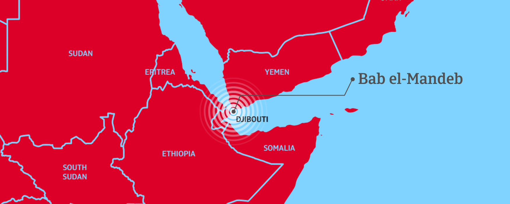
The Bab el‑Mandeb is the only maritime outlet to the Indian Ocean for commercial traffic moving between Europe and Asia via the Red Sea and the Suez Canal. It is an essential corridor, with more than 10% of worldwide seaborne trade passing through its waters. The strait is divided into two navigable channels by Perim Island, a geographical feature that adds operational complexity.
Length: 50 km | Narrowest point: western channel 20 km; eastern channel 3 km
Bordering territories: Yemen, Djibouti, and Eritrea
.2026-04-29-06-59-27.png)
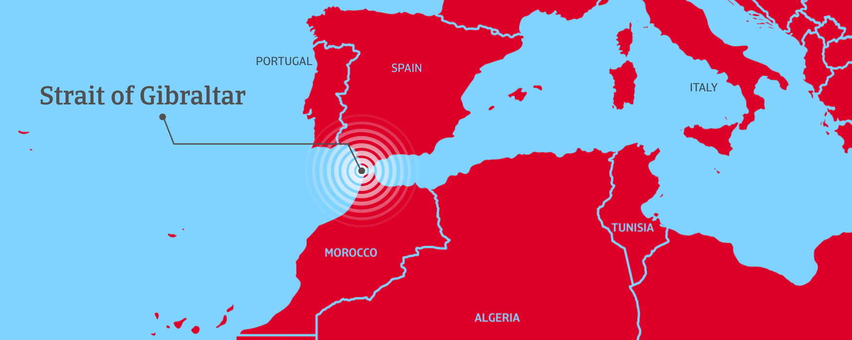
The Strait of Gibraltar is the narrow maritime passage linking the Atlantic Ocean with the Mediterranean Sea. More than ten percent of global maritime traffic transits this corridor, and there is no alternative natural sea route for vessels entering or leaving the Mediterranean. It is a structural dependency for Southern Europe, North Africa, and global supply chains.
Length: 58 km | Narrowest point: 14 km
Bordering territories: Spain, Morocco, and Gibraltar (UK)
.2026-04-29-07-01-32.png)
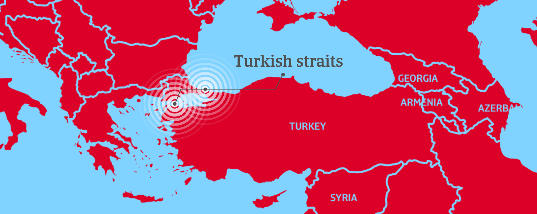
The two Turkish Straits, the Bosphorus and the Dardanelles, form the only maritime connection between the Black Sea and the Mediterranean and constitute the world’s narrowest international strait. This corridor is one of Eurasia’s most strategically sensitive waterways, enabling all seaborne trade from Black Sea economies such as Russia, Ukraine, Romania, Bulgaria, and Georgia to access global markets.
Bosphorus (Black Sea–Sea of Marmara): Length: 30 km | Narrowest point: 750 metres
Dardanelles (Mediterranean–Sea of Marmara): Length: 61 km | Narrowest point: 1.2 km
Bordering territory: Entirely within Turkish territory
.2026-04-29-07-04-35.png)
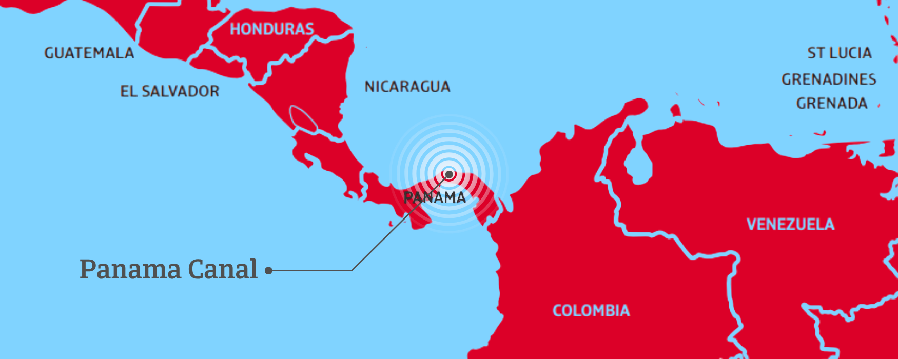
The Panama Canal provides the primary shortcut between the Atlantic and Pacific Oceans, handling around five percent of global maritime trade. Its lock‑based system depends on abundant freshwater, making it uniquely vulnerable to climate‑driven droughts. Since its opening in 1914, this man‑made waterway has eliminated the long and hazardous route around Cape Horn.
Length: 82 km | Narrowest point: 49 metres
Bordering territory: Entirely within Panamanian territory
.2026-04-29-09-31-10.png)
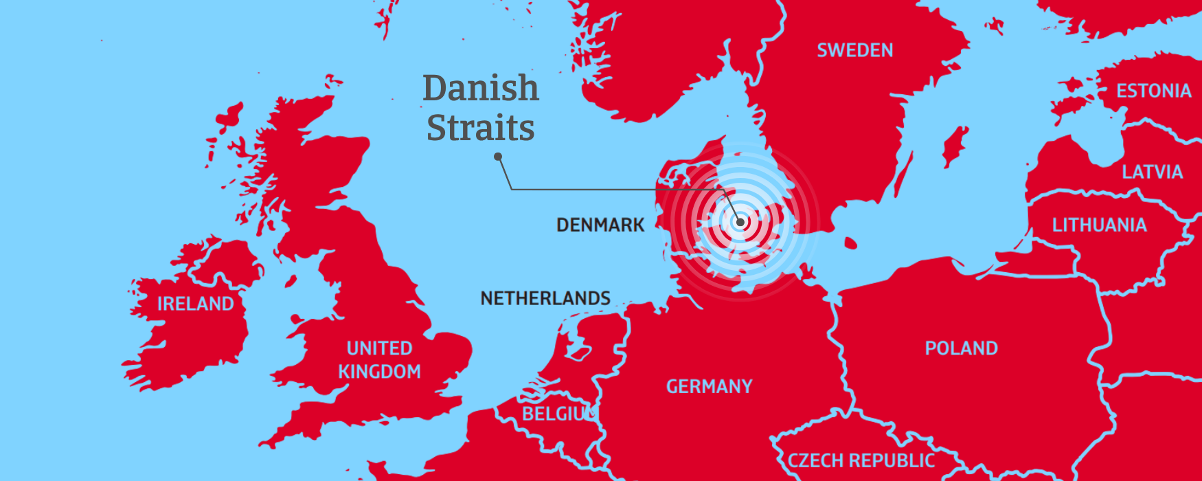
The Danish Straits comprise Øresund, the Great Belt, and the Little Belt; three shallow and narrow waterways that together form the only maritime connection between the Baltic Sea and the North Sea. They constitute a critical transit corridor for Northern European economies such as Sweden, Finland, Poland, the Baltic States, and Germany.
Øresund: Length: 118 km | Narrowest point: 4 km
Great Belt: Length: 60 km | Narrowest point: 16 km
Little Belt: Length: 50 km | Narrowest point: 800 metres
Bordering territories: Denmark, Sweden, and Germany
.2026-04-29-07-14-19.png)
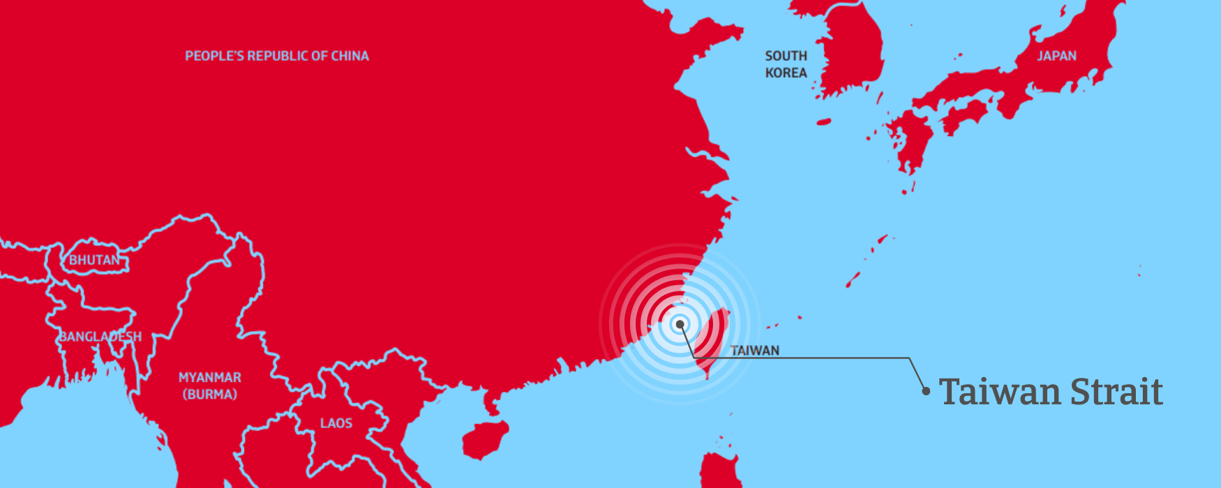
The Taiwan Strait is the stretch of water separating the island of Taiwan from mainland China, linking the South China Sea with the East China Sea and forming one of the Indo‑Pacific region’s most strategically sensitive maritime corridors. It is a critical artery for East Asian trade and global container flows, central to the manufacturing ecosystems of China, Taiwan, Japan, and Southeast Asia.
Length: 370 km | Narrowest point: 126 km
Bordering territories: Taiwan and China
.2026-04-29-07-15-56.png)
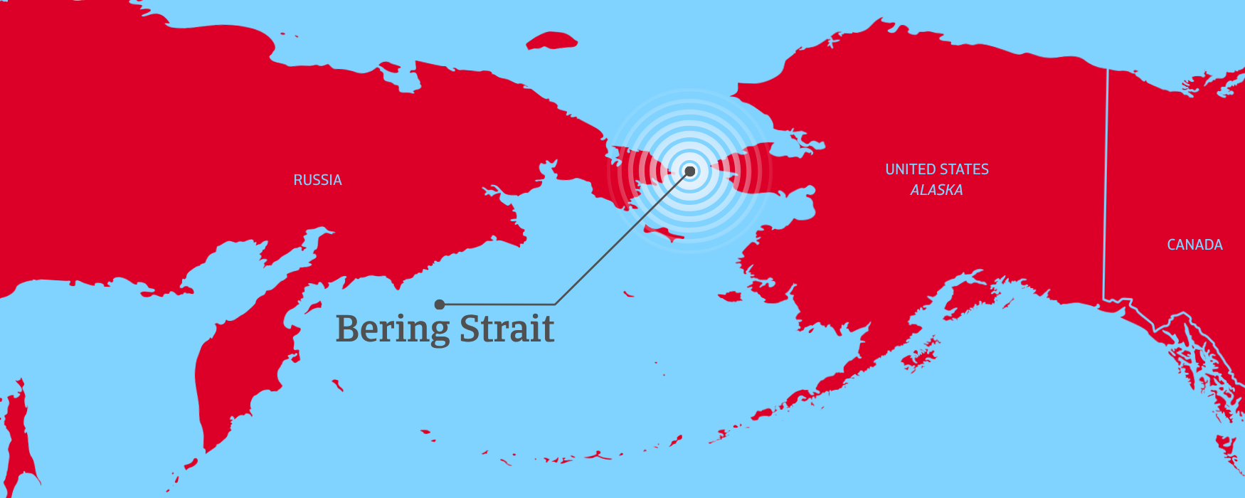
The Bering Strait is a narrow, shallow passage separating Russia from Alaska and connecting the Bering Sea with the Arctic Ocean. Today it plays a limited commercial role, but it is becoming a future‑relevant chokepoint as Arctic navigation expands and seasonal ice retreat opens new trans‑polar routes.
Length: 85 km | Narrowest point: 82 km
Bordering territories: Russia and the United States Export strategy
All these maritime chokepoints share a defining vulnerability: they have no credible substitutes, and the few alternatives that exist are limited, costly, and slow. Rerouting via the Cape of Good Hope when Suez or Bab el‑Mandeb is disrupted adds weeks to sailing times, while the Lombok and Sunda Straits offer deep‑water alternatives to Malacca only through longer and less efficient routes. Together, these constraints underscore the structural difficulty of replacing the world’s major sea corridors.
In environments where trade routes are under strain, some buyers may need additional flexibility to manage delays or adjust shipment schedules. In such situations, Atradius works with customers to ensure that trade credit insurance policies continue to operate effectively while reflecting the evolving risk landscape. Depending on the circumstances, we may adjust certain procedural requirements or timelines within the policy framework, always in line with the contract and without altering the fundamental terms and conditions, helping businesses protect the continuity of their operations.
To explore to strengthen your own credit risk strategy, get in touch with us and see how we can help you stay ahead.
Maritime chokepoints concentrate the flow of global trade through a handful of narrow passages that have no viable alternatives
Diversions exist, but they are slower, costlier, and operationally limited
These corridors enable efficiency but also expose the world economy to structural fragilities: when a single one is disrupted, the effects ripple across supply chains, logistics networks, and production systems